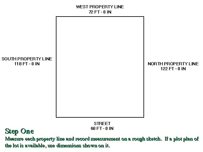
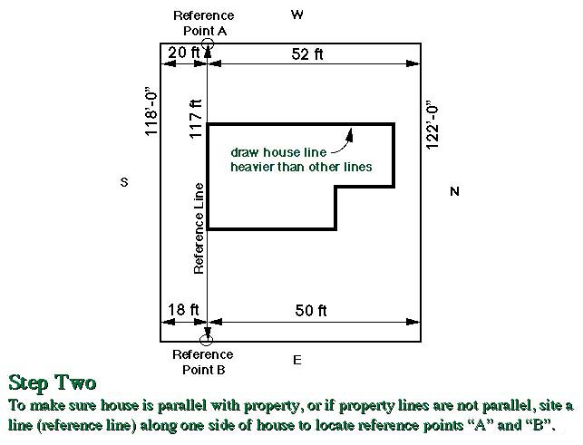
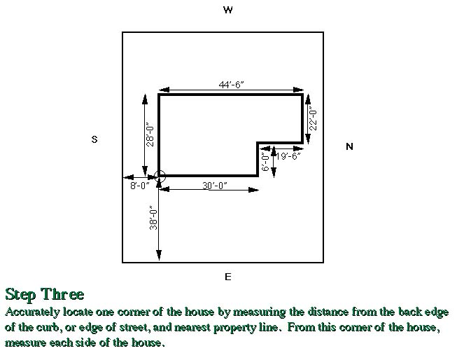
Draw a base plan to scale. For most properties a scale of 1/8″:1′ is workable; for small properties or a particular area of a larger development 1/4″:1′ may be better. Graph paper with lines indicating a particular scale may also be helpful. Include all major features on your drawing such as existing walks, terraces, outbuildings, trees, shrubs, drives, property lines, easements, utilities, etc. After preparing the base plan, place tracing paper or tissue paper over the original plan to sketch possible ideas and solutions to your landscape needs and problems.
Steps for Drawing a Base Plan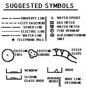
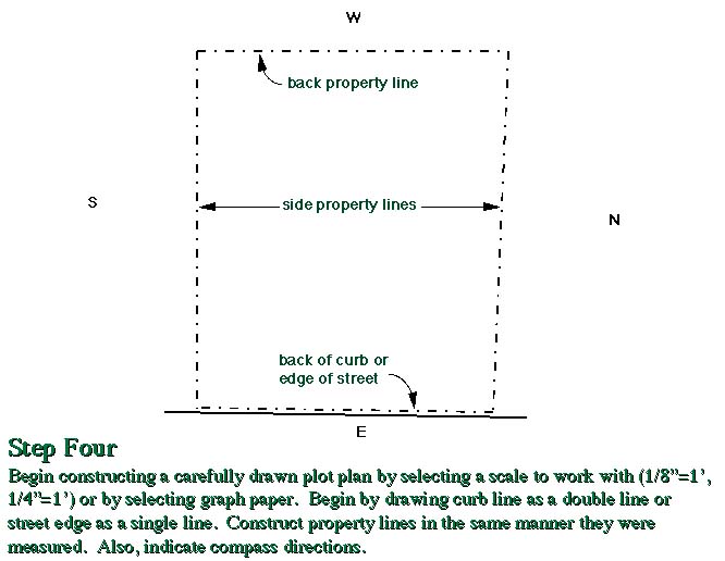
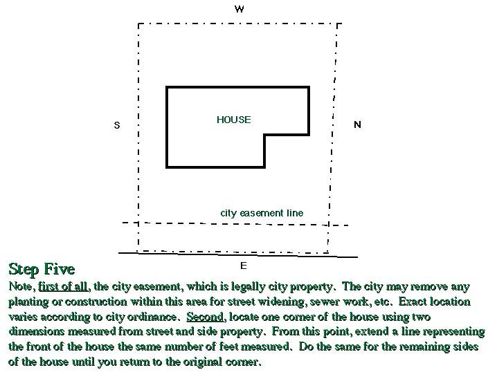
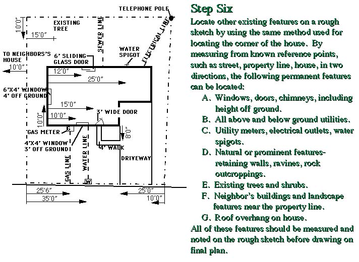
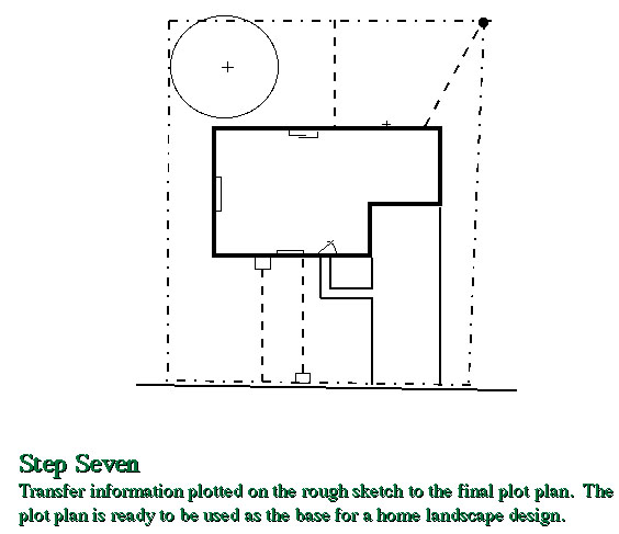
Always indicate compass directions in relation to the house by drawing an arrow (N->) pointing north. You may also want to show the direction of the rising sun. In winter, the sun rises a little south of east and sets a little south of west. In summer, the sun rises somewhat north of east and sets somewhat north of west.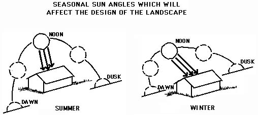
A base plan can also include the location of storm sewers, drainage ditches, and other environmentally sensitive areas. Many base plans include topographical information to assist in developing strategies for controlling runoff. Locating native vegetation and habitat can also be useful in the planning process.

